Private lands accounts for just over half of Oregon’s land base and include farms, range lands, wetlands, forests and stream corridors. To improve landowner-hunter relations and engage landowners in the conservation of fish and wildlife, the Oregon Legislature created the Access & Habitat (A&H) Program in 1993. The law established a funding mechanism to provide grants to private landowners, timber and agriculture corporations, sportsmen groups, natural resource agencies, and others for projects designed to increase public hunting access to private lands and/or improve wildlife habitat.
The program’s motto, “Landowners & Hunters Together for Wildlife,” conveys the program’s basic mission - to foster partnerships between landowners and hunters for the benefit of the wildlife they value. The program also seeks to recognize and encourage the important contributions made by landowners to the state’s wildlife resource.
Southern Portion Map (pdf)
North West Portion Map (pdf)
North East Portion Map (pdf)
Project information: A&H funds are used to fund an Oregon State Police Trooper to patrol private timberlands participating in the TMA. The increased law enforcement provides an incentive to private timberland owners to continue to allow hunting access.
Contact: General TMA Information: ODFW Springfield – 541-726-3515
may vary by landowner
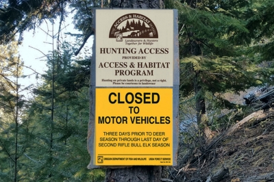
Motorized vehicle travel permitted only on roads shown in green on the TMA map or posted with an orange road marker in the field are open to motor vehicles. Portions of the TMA may be closed due to fire danger or for management reasons. Area open from 1 hour before sunrise until 1 hour after sunset.
Project information: A&H funds are being used to conduct habitat improvement projects on the property. In return, the landowner allows public hunting access on a limited, random basis.
Contact: ODFW La Grande (541) 962-1838
Irrigated pastures and managed rangelands
Project information: The Mid Coast Access Area is made up of three A&H projects, the Weyerhaeuser Access, Weyerhaeuser Westside Access, and the Manulife Westside Access. The projects combine to provide public recreational access to approximately 292,000 acres of privately-owned commercial timberlands. The Mid Coast Access Area will allow motorized access during IFPL 1 and 2, walk-in access during IFPL 3, and closed to all access during IFPL 4. A&H funds are used to pay landowners on a per-acre basis for public hunting access. Maps showing the access provided can be found under the North Coast TMA and the Willamette Private Lands projects below.
Contact: ODFW Newport (541) 867-4741 or Corvallis (541) 757-4186
Maps showing the access provided can be found under the North Coast TMA and Willamette Private Lands projects shown below. A&H funds are used to pay landowners on a per-acre basis for public hunting access.
| Location | Wildlife Mgmt. Unit | Acres | Huntable Species | Access Period | Type of Access | Special Regulations |
|---|---|---|---|---|---|---|
| The lands are entirely within the Oregon Coast Range. They span north to south from Tillamook to Yachats and east to west from the Willamette Valley fringe to the coast. The majority of land is due west of Salem | Trask – 14, Stott Mtn - 17, and Alsea – 18 | 292,520 acres | Elk, deer, bear, cougar, predators, grouse, quail, ducks, geese, turkey, mourning dove. | Year-round. Access limited to walk in only at fire level 3. No public access at fire level 4 and during active logging Operations. | Welcome to Hunt | All gated, posted and/or barrier closed Rds within Alsea, Stott Mtn. and Trask Units. Cooperators require day use only on private lands, no ATV use, no e-bikes, no vehicle may block any Rd or gate, no fires, no camping. Private lands closed to the public 1 hour after sunset to 1 hour before sunrise. |
North Region Map (pdf); South Region Map (pdf)
Project information: These industrial timberlands are a conglomerate of forest land that has multiple owners. A&H funds are being used to hire 5 Oregon State Police Senior Troopers to patrol the private timberlands from August to December. The increased law enforcement provides an incentive to the private landowners to continue to allow hunting access. The following industrial timberland owners participate in the program: Manulife Timber Resources Group, The Hampton Tree Farm Affiliates, Stimson Lumber Company, Weyerhaeuser Company, the Lewis & Clark OR Timber, managed by the Nuveen Capitol, and Rayonie r.
Contact: ODFW Sauvie Island, 503-621-3488 or Tillamook, 503-842-2741
| Location | Wildlife Mgmt. Unit | Acres | Huntable Species | Access Period | Type of Access | Special Regulations |
|---|---|---|---|---|---|---|
| Portions of Clatsop, Columbia, Tillamook, Washington, and Yamhill counties | Saddle Mountain - 10, Scappoose - 11, Wilson - 12, Trask - 14 | estimated 1 million | elk, deer, bear, predators, grouse, quail, band-tailed pigeon | may vary by landowner | may vary by landowner | Area under travel management restriction, consult current Big Game Hunting Regs |
Project cooperators:
Lewis & Clark Timberlands, Seaside Office: 503-738-6351
Weyerhaeuser Columbia Timberlands - Longview: 360-575-5112; Seaside 503-717-8288
Stimson, Forest Grove Office: 503-359-0116
Manulife, Cathlemet Office, 360-795-3221
Hampton, Astoria: 503-458-6111; Wilson Unit: 503-365-8400
Rayonier (Chehalis office) 360-740-4323
State Forestry, Astoria: 503-325-5451; Tillamook 503-842-2545; Forest Grove 503-357-2191
Stott Mtn/N Alsea Map/Hancock FM NW- front (pdf) , Stott Mtn/N Alsea Map/Hancock FM NW- back (pdf)
Project information: A&H funds are used to hire 6 Oregon State Police Senior Troopers to patrol these industrial timberlands which have multiple landowners, from August to December. The increased law enforcement provides an incentive to private timberland owners to continue to allow hunting access. The following industrial timberland owners participate in the program in the Stott Mtn/North Alsea TMA: Manulife (formerly Hancock) , and Weyerhaeuser . In other areas, OSP troopers patrol private timberlands that are open to public hunting.
Contact: ODFW Newport 541-867-4741, Corvallis 541-757-4186, or Springfield 541-726-3515
| Location | Wildlife Mgmt. Unit | Acres | Huntable Species | Access Period | Type of Access | Special Regulations |
|---|---|---|---|---|---|---|
| Portions of Lincoln, Polk, Benton, Marion, Lane, and Linn counties | Santiam Mountain - 17, Alsea - 18, McKenzie - 19, Siuslaw - 20, Indigo - 21 | Estimated 1.25 million | elk, deer, bear, predators, grouse, quail, band-tailed pigeon | may vary by landowner | may vary by landowner | Some areas under travel management restrictions. Consult the current Big Game Regs for more info. |
Project cooperators:
Avery Family Forest: 503-859-2701
Frank Lumber, Mill City: 503-897-2371
Freres Timber Inc, Lyons: 503-859-2121
Giustina Resources, Eugene: 541-485-1500
Hampton Affiliates, Salem: 503-365-8400
Longview Timberlands, Silverton: 503-873-6457
Manulife ( formerly Hancock), : 503-838-1610
Miami Corporation, McMinnville: 503-472-7186
Rosboro Lumber, Springfield: 541-746-8411
Starker Forests, Philomath: 541-929-2477
Stimson Lumber: 503-357-2131
Weyerhaeuser Co (Toll free hunter hotline): 1-888-741-5403
Cascade Timber, Sweet Home: 541-367-2111
State Forestry, Dallas: 503-623-8146, Sweet Home: (541) 367-6108,
Philomath: 541-929-3266
US Forest Service, Siuslaw National Forest Office: 541-750-7000
BLM, Salem: 503-375-5646
Project information: This area is industrial timberland with multiple landowners. An A&H grant is used to partially fund a Sheriff deputy to patrol the timberlands in Linn County. The increased law enforcement provides an incentive to private timberland owners to continue to allow hunting access.
Contact: Brian Carroll– Linn County Forest Protection Association 541-924-6916 ext. 2950
| Location | Wildlife Mgmt. Unit | Acres | Huntable Species | Access Period | Type of Access | Special Regulations |
|---|---|---|---|---|---|---|
| Portions of Linn County | Santiam Unit - 16 | Estimated 300,000 | Elk, deer, bear, predators, grouse, quail, band-tailed pigeon | may vary by landowner | may vary by landower | may vary by landowner |
Project information: An A&H grant is used to partially fund a Sheriff deputy to patrol the multi-owner private, industrial timberlands in Linn County. The increased law enforcement provides an incentive to private timberland owners to continue to allow hunting access.
Contact: ODFW Newport, 541-867-4741
| Location | Wildlife Mgmt. Unit | Acres | Huntable Species | Access Period | Type of Access | Special Regulations |
|---|---|---|---|---|---|---|
| Portions of Lincoln County | Stott Mountain - 17, Alsea - 18 | Estimated 300,000 | elk, deer, bear, predators, grouse, quail, band-tailed pigeon | may vary by landowner | may vary by landowner | Some areas under travel management restriction. Consult the Big Game Regs for more info. |
Map (pdf)
Project information: A&H funds are used to remove blackberry, cut back decadent brush fields, and fertilize pastures. In return, the landowner allows public hunting access on a limited, random basis.
Contact: ODFW Central Point office 541-826-8774
Deer and turkey
Map (pdf)
Project information: Funding will be provided through the A&H Program to FIA companies for access to private lands, and enforcement of travel management area restrictions by OSP.
Contact: ODFW Charleston 541-888-5515
30,696 of private and 34,724 acres of public lands
Primary: Elk, deer, bear, cougar, predators, quail, grouse, turkey Secondary: Band-tailed pigeon, mourning dove, western gray squirrel, furbearers, unprotected mammals
Map (pdf)
Project information: A&H funding provides increased OSP enforcement of the travel management area restrictions. Increased law enforcement on these public and private timberlands provides an incentive for landowners to continue to allow public
hunting access and decrease harassment of wintering wildlife. The project also improves access to 39,028 acres of public land.
Contact: ODFW Central Point, 541-826-8774
| Location | Wildlife Mgmt. Unit | Acres | Huntable Species | Access Period | Type of Access | Special Regulations |
|---|---|---|---|---|---|---|
| Portions of Jackson Co. near Shady Cove and Butte Falls | Dixon - 22, Evans Creek - 29, Rogue - 30 | 13,564 of private and 39,028 of public lands | Primary: Elk, deer, bear, cougar, predators, quail, grouse, turkey Secondary: mourning dove, western gray squirrel, furbearers, unprotected mammals | year-round | Welcome to hunt | Vehicle travel restricted to green dot roads from October 15- April 30 |
Map (pdf)
Project information: A&H funds provide fertilizer to landowners in return for permitting public hunting access.
Contact: ODFW Gold Beach (541) 247-7605
| Location | Wildlife Mgmt. Unit | Acres | Huntable Species | Access Period | Type of Access | Special Regulations |
|---|---|---|---|---|---|---|
| Curry County, South of Bandon, OR. | Sixes – 25 | 3,540. Greatly improves access to 500 acres of BLM land. | Waterfowl | Properties open during zone 1 duck season and South Coast zone goose seasons except as precluded by farming operations. | By Permission | Hunter must obtain permission prior to hunting on the property. Reservations will be booked on a first come, first served basis. |
Page 1 map; Page 2, North map; Page 3, South map
Project information: These timberlands are patrolled by Oregon State Police Special Trooper using A&H funds. Continued vandalism and/or property destruction could lead to the closing of these lands to public use. Please respect private lands.
Contact: ODFW Klamath Falls, 541-883-5732
| Location | Wildlife Mgmt. Unit | Acres | Huntable Species | Access Period | Type of Access | Special Regulations |
|---|---|---|---|---|---|---|
| Scattered parcels in Klamath, Jackson, and Lake counties; see map | Sprague - 33, Silver Lake - 76, Interstate - 75, Klamath Falls - 32, Keno - 31, Fort Rock - 77 | 608,000 | Primary: deer, elk, turkey Secondary: blue grouse, ruffed grouse, mt. quail | year-round (seasonal travel restrictions apply) | Open Access | Camping permitted up to 7 days; no fires, be careful with cigarettes; no littering - pick up any trash; report unlawful activities; do not damage roads during wet conditions; leave gates as you find them. Surveillance cameras may be in use. |
Bentz Map (pdf)
Project information: A&H funds are used to pay the landowner to allow the public to access 4,276 acres of private land and improve access to adjoining public land.
Contact: ODFW Hines, 541-573-6582
| Location | Wildlife Mgmt. Unit | Acres | Huntable Species | Access Period | Types of Access | Special Regulations |
|---|---|---|---|---|---|---|
| South of Juntura off of the Shumway Rd. | Malheur River - Unit 66 | 4,276 | Deer, chukar, predator, antelope, sage-grouse | August 1-March 1, through March of 2027 | Welcome to Hunt | Motorized vehicle travel only on BLM access road posted as open |
Map (pdf)
Project information: A&H funds are used to pay the landowner for access to 12,105 acres of his rangeland property.
Contact: ODFW Hines, 541-573-6582
| Location | Wildlife Mgmt. Unit | Acres | Huntable Species | Access Period | Type of Access | Special Regulations |
|---|---|---|---|---|---|---|
| From Burns, travel approx. 35 miles east on Hwy 20, then north on County Rd. 310. Look for access. | Malheur River Unit - 66 | 12,104 | Primary: deer, elk, pronghorn, predators Secondary: turkey, California quail | August 1-March 1, through March of 2026 | Open Access | No camping on private lands; no fires; leave gates as you find them. See map for further regulations. |
Map (pdf)
Project information: A&H funds are used to pay the landowner for access. The land includes rangeland, steep rimrock, and brushy, riparian zones.
Contact: ODFW Hines, 541-573-6582
| Location | Wildlife Mgmt. Unit | Acres | Huntable Species | Access Period | Type of Access | Special Regulations |
|---|---|---|---|---|---|---|
| East Steens Rd (Co. 201), 28 miles north of Fields, OR | Steens Mountain - 69 | 5,850 | deer, sheep, pronghorn, predators, chukar, quail | August 1-March 1, through March of 2027 | Open Access | Vehicle access restricted to roads posted and mapped as open |
Map (pdf)
Project information: A&H funds pay for maps, signs and survey permits.
Contact: ODFW Ontario, 541-889-6975
| Location | Wildlife Mgmt. Unit | Acres | Huntable Species | Access Period | Type of Access | Special Regulations |
|---|---|---|---|---|---|---|
| City of Ontario | Beulah - 65 | 800 | Primary: pheasant, duck, geese, mule deer (archery only); quail Secondary: turkey | Year round; through December 31, 2020. Hunting permitted for upland birds, waterfowl, and deer (archery) during prescribed seasons only. | Open Access | Parking in designated areas only. Please be mindful of farming equipment on property; vandals will be prosecuted. |
Map (pdf)
Project information: A&H funds are used to pay landowners on a per acre basis for public hunting access.
Contact: ODFW Hines, 541-573-6582
8,187
Welcome to Hunt
4,770 by Permission
Map (pdf)
Project information: A&H funds are used to pay the landowner for access to 16,734 acres of his property.
Contact: ODFW Hines, 541-573-6582
August 1-March 1, through March of 2027
Map (pdf)
Project information: A&H funds are used to pay 4 landowners a per acre value for public hunting access. The land includes flat, lake basin pastureland that is wetland during high water years.
Contact: ODFW Hines, 541-573-6582
August 1-March 10, through March of 2027
Map (pdf)
Project information: A&H funds are used to pay the landowner for access to his property and drive-through access to thousands of acres of public land that are virtually inaccessible without this project. The lands made available through this project include rangeland, steep rimrock, and brushy, riparian areas.
Contact: ODFW Hines, 541-573-6582
| Location | Wildlife Mgmt. Unit | Acres | Huntable Species | Access Period | Type of Access | Special Regulations |
|---|---|---|---|---|---|---|
| East Steens Rd (Co. 201), 28 miles north of Fields | Steens Mountain - 69 | 3,532 | deer, sheep, pronghorn, predator, chukar, quail, sage grouse | August 1-July 31, through March 1 2024 | Open Access | Vehicle access restricted to roads posted and mapped as open. Hunters must check in at Alvord Hot Springs prior to accessing the area. |
Map (pdf)
Project information: A&H funds are used to pay the landowner for access to this rangeland.
Contact: ODFW Ontario, 541-889-6975
| Location | Wildlife Mgmt. Unit | Acres | Huntable Species | Access Period | Type of Access | Special Regulations |
|---|---|---|---|---|---|---|
| See map, multiple parcels in central Malheur County | Owyhee - 67 | 11,029 | deer, pronghorn, chukar, quail, sage grouse, predator | August 1-March 1, through March of 2026 | Open Access | No camping on private land; no fires; leave gates as you found them. See map for further regulations. |
Project information: A&H funds are used to conduct habitat improvements and to pay the landowner on a per-acre basis for public hunting access. Additionally this project will improve access to adjacent public lands.
Contact: ODFW La Grande (541) 962-1838
Managed Timberlands and Rangelands surrounded by public lands and other private lands
Project information: A&H funds are being used to conduct habitat improvement projects on the property. In return, the landowner allows public hunting access on a limited, random basis.
Contact: ODFW La Grande (541) 962-1838
Irrigated pastures, timberlands, and managed rangelands
Map available from Salem Headquarters, and www.oregonhuntingmap.com.
Project information: A&H funds are used to pay landowners on a per-acre basis for public hunting access.
Contact: ODFW Northeast Region Office (541) 962-1838
April 1-March 31, through March of 2025
Map Page 1 | Page 2 (pdf)
Project information: A&H funds are used to pay landowners on a per-acre basis for public hunting access.
Contact: ODFW Heppner (541) 676-5230
Primary: Mule deer, pheasant, quail, Hungarian partridge, grouse, dove
Secondary: elk, pronghorn, bear, turkey, predators
February 1-January 31, through January 31 2026
Map (pdf)
Project information: A&H funds are used to pay the landowner on a per acre basis for public hunting access.
Contact: ODFW Baker City, 541-523-5832
Map (pdf)
Project information: Provides access to 4,215 acres of previously inaccessible BLM land. A&H funds are used to pay the landowner on a per acre basis for public hunting access. The area includes lower/mid elevation sagebrush steppe and high elevation conifer and aspen forests.
Contact: ODFW Baker City, 541-523-5832
| Location | Wildlife Mgmt. Unit | Acres | Huntable Species | Access Period | Type of Access | Special Regulations |
|---|---|---|---|---|---|---|
| I-84 eastbound to exit 327 at Durkee. Hwy 30 north to Land Rd.; Land Rd. north to Hindman Rd.; Hindman Rd. north to Iron Mountain Rd. Follow Iron Mountain Rd. to property boundary. | Lookout Mountain - 64 | 3,342 | deer, elk, chukar | Aug 1 - Jan 31; through Jan 2026 | Open Access | No morotized vehicles; walk in hunting only (horses and bicycles ok). No camping, no fires, be careful with cigarettes. No littering, pick up any trash. Leave gates as you found them. |
Map (pdf)
Project information: A&H funds are used to pay landowners on a per acre basis for public hunting access to this rangeland area which is surrounded by public land.
Contact: ODFW Baker City, 541-523-5832
August 1-January 31, through January 31 of 2027
Map (pdf)
Project information: A&H funds are used to pay landowners on a per acre basis for public hunting access.This area is priarmily rangeland and is surrounded by public land.
Contact: ODFW Baker City, 541-523-5832
August 1-January 31, through January 31 of 2026
Map (pdf)
Project information: A&H funds are used to pay landowners on a per acre basis for public hunting access. The land is rangeland and is surrounded by public land.
Contact: ODFW La Grande, 541-962-1838
| Location | Wildlife Mgmt. Unit | Acres | Huntable Species | Access Period | Type of Access | Special Regulations |
|---|---|---|---|---|---|---|
| 7 miles south of La Grande | Starkey - 52 | 4,164 | mule deer, white-tailed deer, elk, waterfowl, quail | April 1 - Jan 31 through 2021 | Open Access | Permission required to access Zone B (see map); reservations booked on first come, first served basis. Contact ODFW -La Grande to book (541-926-1838). |
Noregaard Map (pdf) Shamrock/Whisky Creek Map (pdf), Little Catherine Ck (pdf), Meacham (pdf)
Project information: These areas are part of the Hancock Forest Management NE Access Project providing access to industrial timber lands. A&H license dollars and funds from Natural Resources Conservation Service grant provide access to 250,000 acres of private land.
Contact: Enterprise ODFW, 541-426-3279
| Location | Wildlife Mgmt. Unit | Acres | Huntable Species | Access Period | Type of Access | Special Regulations |
|---|---|---|---|---|---|---|
| Wallowa Co. north of Wallowa | Sled Springs - 57, Catherine Creek - 53, Ukia - 49, Starkey - 52, Mt. Emily - 54 | 127,000 | elk, deer, bear, predators, grouse, turkey | Year-round | Open Access | Area under travel management restriction 3 days prior to opening of archery season through May 31; consult the current Big Game Hunting Regs for more information. |
Map (pdf)
Project information: This area is primarily rangeland adjacent to public land. A&H funds are used to pay landowner on a per-acre basis for public hunting access.
Contact: ODFW La Grande, 541-962-1838
August 1-January 31, through January 31 of 2024
Map (pdf)
Project information: Primarily rangeland surrounded by public land made available through A&H funds which are used to pay landowner on a per-acre basis for public hunting access.
Contact: ODFW Baker City, 541-523-5832
August 1-July 31, through July 31 of 2026
Map (pdf)
Project information: A&H funds are used to pay landowner on a per-acre basis for public hunting access. This area is mixed forest and meadows, surrounded by public land
Contact: ODFW Baker City, 541-523-5832
August 1-September 30, through January 31 of 2025
Catherine Creek WMU Map (pdf), Starkey WMU Map (pdf), Sumpter WMU Map (pdf), Walla Walla WMU & Vicinity Map (pdf), Wenaha WMU Map (pdf)
Project information: A&H license dollars and funds from Natural Resources Conservation Service grant provide access to 250,000 acres of these industrial timberlands.
Contact: ODFW LaGrande 541-962-1838
| Location | Wildlife Mgmt. Unit | Acres | Huntable Species | Access Period | Type of Access | Special Regulations |
|---|---|---|---|---|---|---|
| Wallowa Co. north of Wallowa, Union Co. east of Union, Umatilla Co. near Meacham | Sled Springs - 57, Catherine Creek - 53, Ukia - 49, Starkey - 52, Mt. Emily - 54 | 250,000 | mule deer, elk, forest grouse, turkey, bear | Year-round through 2021 | Open Access | Notice: Hancock F.M. Inc. does not allow unauthorized commercial packing, guiding, or hunting services or commercial gathering of firewood or mushrooms on its lands |

For the best viewing experience turn on the thumbnail option.
Access and Habitat Program Coordinator
4034 Fairview Industrial Dr. SE
Salem, OR 97302
Tel: 503-947-6087
Fax: 503-947-6330
Header image by Kathy Munsel